Monday, March 9, 2020

Route 66 Gallup, New Mexico to Amarillo, Texas: May 25, 2019 Day 4 Albuquerque to Bernalillo, New Mexico

Brother Mark posted on our Facebook page for this day:

Day 4:  NM-TX-OK Route 66 Trek
Crossing the Rio Grande

Woke up to a "soft" front tire this AM.  This is not unexpected after riding 14 miles on the Interstate yesterday.  Tiny wires from pieces of tires are strewn over the shoulder (see photo below).

A quick tube change and we were on our way.  (Flat Score:  Kent-1, Mark-1).

Route 66 Casino Hotel, where we stayed last night, is located on the Rio Puerco River.  So our first 5 miles (8 km)  this morning was a long, grueling climb to a hill called "Lost Horizon."

[This "climb" up the Lost Horizon represents the eastern boundary of the Colorado Plateau, a major geological/ecological feature defining the nature of much of the Southwestern USA]. 

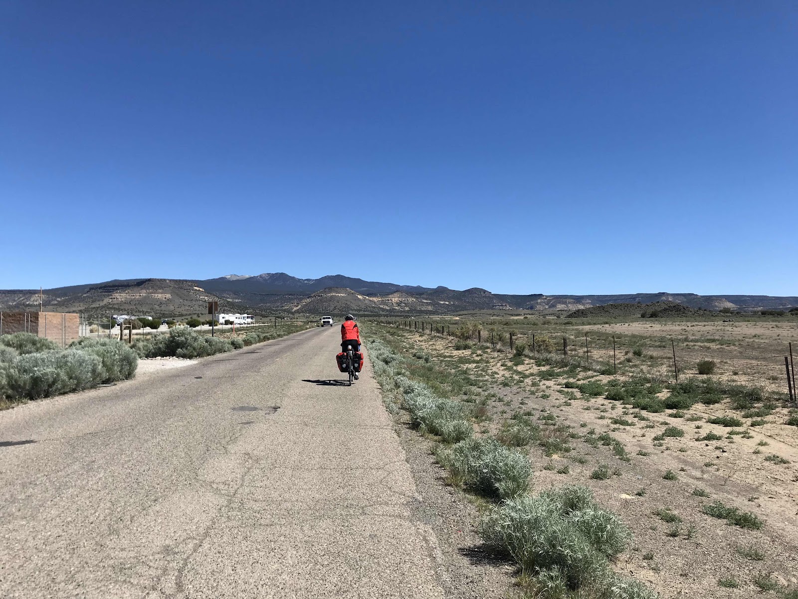
But soon after that we coasted ["Flew" might be a better word!] down to the Rio Grande and Downtown Albuquerque on Route 66.

We figured out today we rode perpendicular through the Monarch butterfly migration going north!  \

At times we saw many of them crossing our path in flight, and found way too many that didn't make, and were now laying motionless on the road.

Even though much of 66 through Albuquerque has been modernized, there are some very distinct New Mexican remnants of the Mother Road to be enjoyed.

Recent good friends and cycling buddies (Thanks, Steve Doyle!), Susan and Dan Kutvirt, live just a couple of miles off Route 66, and Dan cooked us lunch. [I believe in his spare time Dan operates a first class pasta factory supplying many retailers of fine food.]

After a great (but too short) visit with Susan and Dan, Dan led us back to Route 66 via a paved bike trail.  It gave us a welcome relief from traffic!

Our 42 mile day ended at the Coronado Campground, run by the City of Bernalillo.

Our camping shelter overlooks the Rio Grande in the shadow of the Sandia Mountains.  Quite idyllic!

Tomorrow we climb over 2,000 ft to Santa Fe.  Hoping for an early start.


Shortly after departing our plush hotel, we find this preserved bridge beckoning back to the "real" days of Route 66 travel.


About five minutes past the bridge, Bro Mark goes flat.

Doesn't take long to fix. He's incredibly well practiced and very skilled at this procedure.


Our 5 mile (8 km) climb to the edge of Albuquerque provides a great morning cardio workout.

I pause at the top of the hill descending into the city.

In a few yards (meters) the downhill grade increases dramatically.

I use my brake to slow things down as my very heavily loaded bike begins wobbling and shaking like an unevenly loaded washing machine.  


We enjoy a wonderful lunch with Susan and Dan.

Wish we could have visit much longer, but the sun keeps moving even when we don't.

Dan, a cycling enthusiast himself, personally guides us north out of the city on a few miles (km) of the very impressive 400 miles (650 km) of bike paths and trails created by the city.

I'm guessing Albuquerque nears the top of US cities for designated bike routes proportional to population; "only" 500,000 people call Albuquerque their home!

Our path follows along the edge of the iconic Rio Grande River as it weaves its way south through the city.


We reconnect with Route 66 heading north out of the city.

A few hours later, we reach our well maintained city campground near Bernalilllo.

We deposit our heavy loads in our concrete camp structure and deal with the first and most important matter - Refueling.

Heaven smiled down on us and provided an iHop (International House of Pancakes) Restaurant.

They serve much more than just pancakes.

Notice in photo we eat dessert first. Cool people do so, and Brother Mark couldn't be more cool than he presents in this photo :-)


Back at the campground we shower and enjoy the view from our campsite.


As daylight diminishes, we erect our shelters.

We hope to rest well tonight. Tomorrow we do some serious climbing. The first of several days of serious climbing.

We must cross over the Sangre de Christo ("Blood of Christ") Mountains, inaccurately, in my opinion, referred to as the "foothills" of the Rocky Mountains.

Tomorrow two cyclists will discover there's nothing "foothill-ish" about them!


Sunday, March 8, 2020

Route 66 Gallup to Amarillio: May 24. 2019 Day 3 - Acomita to Albuquerque, New Mexico


Day 3: Acomita Village/Sky City to (almost) Albuquerque, New Mexico

Mark posted this Shelley Brothers Cycling Adventures Facebook page entry for today's ride:

Although we had to wait until mid-morning for the temps to warm up, it turned out to be a great day for cycling adventures.

The wind decreased considerably, and we were able to find and ride on a lot of the older sections of Route 66.

Instead off cutting through the mountains and mesas, much of Route 66 hugged the base of these landscapes, which made for more curves, fewer cars and some really breathtaking scenic moments (which fail to be captured adequately in photos).

We rode 7 miles on an old section not even marked as Historic Route 66, though earlier maps and other sources assured us it was indeed 66.

Much (but not all) the asphalt was still there.  At one point, our path was blocked by a fence declaring it as "Indian land--No Trespassing"!

The last 14 miles (22 km) were on Interstate 40, going up and down long and relative steep inclines.

A total of 45 miles (73 km) brought us to the Route 66 Casino Hotel--our home for this evening.

All in all, a great day for bicycle touring!

Photos from today's ride:


Winds calmed down considerably. Temperatures rose to a more pleasant level.

Our Casino Hotel is located next to the Interstate Highway. But a short 2 km (1 mi) ride east reunited us with Route 66.

I could feel the magic at the very moment. We were now on a non-commercialized segment of 66.

Almost like a Time Machine, we travel back to at least the 1950's and find ourselves in a different world, a different time.


The Interstate Highway CUTS through the land. Hills and rocks and valleys are obstacles in the way requiring removal.

In contrast, Old Route 66 FLOWS with the land, welcoming it and embracing it with respect, providing enchanting views and moments, especially when experienced on the slower, more-at-one-and-in-the-moment-with-the-environment of cycling.

This first segment of today's ride ranks as one of my two most favourite sections of Route 66. Some of the best bike touring and visuals between Chicago, Illinois and Los Angeles, California.


Welcome to Elephant Rock.

It looks very much like an elephant when you see the whole thing when approached from the east heading west.

Unfortunately, since we are travelling west to east (so as to be pushed along occasionally by the prevailing winds), I failed to get a picture of it.


Purposeful and personal graffiti speaks from this rock as travelers from the 1920's to present day record their names upon it.

Elephant Rock served as a welcome landmark to over 200,000 climate refugees fleeing the uninhabitable American Mid West Dust Bowl on their way to California via Route 66 in the 1930s.

American folksinger Woody Guthrie captured that reality when he sang,

We loaded up our jalopies and piled our families in,
We rattled down that highway [Route 66] to never come back again.
("Dust Bowl Disaster")


Which part of the Elephant might this be?


Nature and history felt so close today.


Flat mesa top reminds us that we now ride along the bottom of  what was once a vast ocean covering the American southwest.

The flat top of the Mesa was beach front property back then.


The bigness and openness of this country defies words. (That's me pedalling along.)


Brother Mark has a knack for discovering these old old sections of Route 66 that were left to die when the route was realigned for one reason or another.

This bumpy old pavement wasn't the most comfortable ride, but well worth it. These old sections seem to be maintained just enough to adequately service the sparse population utilizing them.

We see the sights and hear the sound of the wind much like the pilgrims in Woody Guthrie's song.

I say very literally that our bums truly felt history on this road!


Old house of rocks long abandoned. Soot still blackens the rocks above the fireplace.

Who might have lived here? Where did they come from? How did they thrive, or perhaps just survive? Where did they go? When?

I ask myself this question many times as we ride Route 66.


Someone still lives on these lands. No houses or buildings in view. But somewhere the West stills lives on.

I googled "Highland Meadows Estates" to discover somewhere down this lane-way are 29 one acre lots that can be purchased for $45,000 each. Build your home here. Average well is 100-300 ft deep.

I didn't see any homes for a long ways away (?)


Our old segment of Route 66 gets older, or perhaps just less used.


Now we're talking really old Route 66. I take this photo from the shoulder of Interstate 40.

Mark isn't with me at the moment.

When the bumpy pavement turned to soft sandy dirt road, I opted out, preferring the pavement of
over the Interstate.

Our map showed the sandy road cutting cross country a few kilometers (miles) and intersecting about where I stand as I take this photo. Mark decided he would try navigating it and meet up with me here.

He didn't show up.

I waited.

Finally he came.

But not on this dirt road.

Riding up from behind on the Interstate shoulder, he explained what happened.

Shortly after taking the road less traveled he encountered clearly posted signs informing him he was on Native American land, and requested he respect their property by not trespassing. He respected.


Because he can read.


Interstate 40 isn't kind to snakes.


For the last part of today's ride we cycle on the hot, loud, and ups and downs of the Interstate.


Ain't that the biggest gasoline pump you ever seen?


We reach our motel for the night.


Fascinating to observe the seriousness and intensity of concentration manifested in this place.

I think they're having fun (?)


One of my kids and I stayed here about three years ago.

At that time a scaled down carpeted Route 66 highway weaved through the building.

Someone remodeled.

I like the old design better.

Time to rest up for tomorrow's ride.


Sunday, December 29, 2019

Route 66 Gallup to Amarillo: May 23, 2019 Day 2 - Grants to Acomita, New Mexico

(Shelley Brothers Cycling Adventure Facebook post composed by Kent at our destination while Mark walked next door to the truck stop to do our laundry.)

Day 2: Grants to Acomita Village, New Mexico 

What’s the best way to experience the removal of a painful band aid? Quickly: Get it over with fast, in shortest time possible. 

That describes Day 2 of our ride. 

A short distance. About 20 miles (37 km). Planned on purpose as a semi-recovery day due to our mega long, cold ride yesterday. 

Not quite as cold today, but even stronger winds (Gusting 35 mph/56 kph), taking turns hitting us from front, side, and rear!

We had a difficult time not being blow over on our sides.

We had to pedal forcefully to move forward, even required to pedal when going downhill. But when blasted from behind, we accelerated like rockets.

Thus, the overall ride speed average of about 10 mph (16 kph). Our fastest speed was about 30 mph (47 kph). 

But it all happened fast: We only pedalled for 2 hours and 11 minutes. (Didn’t seem that fast to me!) The whole trip required about 3 hours. We retreated mid-way into a travel plaza to warm up and eat something.

Now we rest/recover at the Sky City Casino and Hotel. (I might go and demonstrate my expertise at the bingo table tonight 😜). 

And we’d better rest well. Back to more standard touring distances in the morning. About 47 miles (75 km) to Albuquerque. Temps may reach into the high 70’s and low 80’s (high 20’s and low 30’s C). .


Beautiful countryside views today.

Lots of rolling hills.

Very low traffic volume.

On the cool side, with the strong winds penetrating most of our protective clothing.

While a little warmer today, we have yet to experience the slightly higher seasonal norms.


About 37 km (20 miles) from here, one finds the longest continuously inhabited community in the USA, and maybe North America!

The Acoma tribes have occupied this community for over 2,000 years. That's an example of stability and perseverance.

Unfortunately, we will not be able to visit the community on this bike trek. (Photo from our friends at Wikipedia.) It's now on my bucket list.


We pedal up a slight incline to a small plateau and discover remains of a once vibrant Whiting Bros Gasoline Station, Motel, and Grocery Store.

Whiting Bros seems to be about as iconic as Route 66 itself.

The parent company started in 1917 in Arizona with success in the lumber and real estate business, plus a few other ventures.

In 1926, not inconsequentially the same year of the birth of Route 66, Whiting Bros began opening  up gasoline stations, motels, and truck stops along Route 66. At the height of their success, they had over 100 gas stations. About 40 of them were on Route 66, and operated them very successfully until the 1970's.

But the 1970's initiated the not-so-slow demise of Route 66 and the associated business enterprises living off its life energy.

The United States Interstate Highway network, with its construction initiated in the 1950's, had grown and was by then linking together major American population centers separated by great distances.

Long stretches across remote and sparsely populated regions, once the sole domain of the one and only (almost) Trans-America Highway, Route 66, were now being claimed by the faster and time-efficient high speed Interstates.

All of a sudden, it seems, most American motorized vehicle travel became more about the Destination than the Journey.

The Magic of Route 66 began fading in the shadow of higher speed efficiency.

Whiting Bros, as with most commercial enterprises along Route 66 in the 70's, started selling off still moderately viable business locations. (Top brass in the company could see the handwriting on the wall.)

Unfortunately, with time, most of the optimistic new owners would also abandon ship.

Every time we ride by these kinds ruins, I sense a bit of the Magic lingering.

I hear the echo of a time not so long ago when people had a spirit of adventure and connection to each other and to the land and the journey. Something now all too rare in our automated and technologically driven culture. (Perhaps this is why the bicycle seems to at home on Route 66.)

These remains remind me of, and help me rediscover, something of a fading part of our humanity.


We arrive at our destination.

Just like Dr Who's TARDIS,  The Sky City Hotel and Casino is "bigger on the inside."

A beautifully designed and smoothly operated establishment with some of the most helpful and friendliest staff we've ever met.

Arriving early, we weren't surprised to find a room was not ready for us. No problem. We were prepared to walk across the street to the McDonald's and chill out with a McFlurry or something.

But just before we did so, the helpful and friendly staff suggested we let them guard our bikes, while we rested our tired and chilled bodies in their............


HOT TUB! So we did. (I'm the Cool Dude with the Shades :-)


Today's ride.


Today's ups and downs and fasts and slows. 

Saturday, December 28, 2019

Route 66 Gallup to Amarillo: May 22, 2019 Day 1 - Gallup to Grants, New Mexico

Brother Mark's entry in our Shelley Brothers Cycling Adventures Facebook page today:

Day 1: "Top of the World"-Over the Continental Divide

Rule #1 of Bicycle Touring--Be flexible, because RARELY does a trip go as planned.

Well...this time that happened om Day 1.  

Because of major road construction on I-40 and "iffy" conditions on that stretch, we had originally planned on following the Adventure Cycling Association's route south through El Morro and El Malpais National Monuments.  But we woke up to forecasts of near freezing temps tonight and high winds throughout.

We agreed that our "3 season" gear probably wouldn't do well in these elements, so we revised our riding plans and stayed true to Route 66 to Grants, which was 10 miles further than we planned to ride today.

The road conditions were indeed NOT great, but the construction crews allowed us to ride where they were working, separated from traffic.  Although the riding was harder ( dirt and sand), it was definitely safer.

We made it over the Continental Divide at 7245 feet above sea level, then another 35 miles into Grants, for a total of 64 miles today.

Winds gusted up to 35 mph, making our ride a bit challenging.

We're spending the evening eating pizza and trying to raise our body temperatures back into the normal range.


Pedalling out of Gallup with the sun clearing the eastern horizon we are are treated to beautiful iconic Southwest vistas.

Also notice the almost constant train track feature more often than not paralleling Route 66 in this region.


So grateful for the thoughtfulness of the construction workers permitting and encouraging us to ride on their road-building-in-process.

Those transport trucks would be way to close if we were riding on the other side of that barrier.

The mostly hard packed gravel road not really a major problem for our slightly-wider-than-usual cyclocross tires.


About 70 km (43 miles) literally "up" the road we cross the Continental Divide; the geographical watershed for the east and west of the USA.

Water falling on the east side of this area flows towards the Mississippi River and down to the Gulf of Mexico at New Orleans.

Water falling on the west side of this area flows towards the Pacific Ocean.


Mark stands right on the Continental Divide.

Even though the mid-day sun shines upon him, notice Mark dresses for warmth, typical for the first few days of this trip.


Pick your elevation of preference.

This sign, just across the parking lot from the previous photo informs that we are now 30 ft higher.

Who knows?

Such elevation deserves respect, but this won't be our highest elevation on the trip. Nor will today's mountains be our steepest and most challenging. (Notice nothing screams "Mountains" in today's photos!) That adventure comes in a couple of days.


For the next 35 km (22 miles) Route 66 gets designated as a Service Road for the Interstate. Low traffic and safe. We like it.


Kent wins the prize for first flat tire of the trip. An expert flat tire repair person, he quickly and skillfully dazzles the non-existent crowd of onlookers with his professional prowess.


We love this part of the USA as it provides a continuous feast of natural beauty for the eyes.


102.3 km (63 mi) along Route 66 finds us at our vintage motel for the night.

Clean, simple, warm. All we need.

We climbed 368 m (1,207 ft). We averaged 15.7 kph (9.7 mph).

Getting warm and eating pizza for supper now priority #1, then shower and rest up for tomorrow's adventure.


Today's route.


An almost symmetrical elevation profile for our ride.


The riders on the bikes speed up and down throughout the day.

Friday, December 13, 2019

Route 66 May 2019: Gallup New Mexico to Amarillo Texas: Day 0 - Getting to the Starting Line

Day Zero - Getting to the Starting Line
May 21, 2019

Shelley Brothers about to hit Route 66 again.

Our Goal: Pedal from Gallup, New Mexico, across and through Texas, to Oklahoma City.

About three weeks of cycling delight.

But first, I must find my way from Ontario, Canada to Arizona, USA.

Southwest Airlines helps me get to Arizona from the Wayne County Airport in Detroit, Michigan.

I ship my bike ahead of me the week before by UPS utilizing BikeFlights. Just a little easier than lugging all my bike gear (several bags) and a big bike box through the DTW airport and clearance through US Customs.

The photos summarize what happened next.


Having arrived a couple of days before our actual departure from Gallup New Mexico, I get to visit for a bit with my son, Luke, and his partner, Erint. Luke is a Canadian gone Arizonian.

Me, Luke, and Mark manage to squeeze in a Diamond Back Baseball Game in Phoenix. (Photo above.) Too bad there's not much of a family resemblance, eh?

(In Canada we say, "Eh?" - Pronounced like a "long" A at the end of questions so as to open the door for the listener's reflection or response. It's a Canadian thing. American's often say, "Huh?" to achieve the same goal.)


Luke really wanted to join us on his bike. But alas, he had no vacation time off from work.

He'll have to save his powerful wheels for a future ride.


Mike and Heather Davis, two very delightful friends of Mark, graciously transported us on the 5 hour drive to Gallup. 

They delivered us to our vintage Route 66 Motel, the Colonial. (I got to wonder if this motel name is a veiled reference to the national imperialistic North American agenda by Europeans that created so much of the painful legacy among the Native population and the white man's relationship with them that still persists today?)


Mark stands in the motor court, as they once called these places, trying not to shiver.

It is as cold as those clouds are gray.

These very unseasonably cool temps drop below freezing at night, and just barely climb above that during the day, presented an unexpected surprise and challenge for us cyclists.

We were prepared for seasonably cool temps, not unseasonably cold temps.


After supper, we had a few hours "free," so we Ubered to the local theatre and viewed "Avengers: End Game."

Mark's first time to see it. My second time.

I cried for a second time. I won't explain why so as to not spoil the movie if you are one of the few people in the universe not to have seen it.

Whenever we stepped out of our motel, we wore every piece of light clothing we brought.

Our growing realization of this really cool challenge, would lead us to a conversation later that evening resulting in the first of several major modifications we would make on this trip.

There are ALWAYS major modifications to our carefully crafted cycling plans. As Mark's partner, Carolyn, observed, "These trip never go the way you plan them." She's righter than rain. We've grown accustomed to being observant, flexible, and resorting to extreme creativity on our cycling adventures.

In the photo you see my bike loaded and ready to ride in the morning.

If it looks heavy, that's because it is. For me, this was the heaviest load of equipment I had ever carried. I believe Mark would say the same for himself.


Here we are. Packed and warm in our motel room.

This created a conversation about the compatibility of our planned route, and the weather cards we are being dealt by nature.

Our plan for our next day of riding was off of Route 66. The original Route 66 is literally buried under the multiple lanes of the major high speed Interstate 40, and, long stretches of that Interstate were under major repair or expansion construction involving lane reductions --  meaning less road shoulder for relatively small bikes to share with very big and fast cars and trucks.

Our original plan was to utilize Arizona State Highway 53, a two lane not-much-traffic road that would take us to El Morro for our first evening on the ride. El Morro hosts some of the earliest remains of North America's Indigenous  population.

After camping in El Morro, we would pedal on Day 2 to a motel in Grants, New Mexico.

But it would also mean we are camping out tomorrow night in a primitive campground in sleeping bags ill-suited for the below freezing temps forecast.

As much as we wanted to view this unique site, we decided to re-route.

Rather than heading to El Morro, we decided to brave the Interstate Highway up and over the regional mountain pass and pedal non-stop to our motel in Grants.

By Re-routing like this we will also be combining two days of travel into one day, creating one of our longest and most strenuously challenging days for the entire trek, right on our first day.

We are being either courageous or crazy or both in doing this.

Inasmuch as this is the first day of our trip, such long distances are not usually a good idea. The first few days of a bike trip are usually for conditioning -- for finding our leg muscles and adapting to the higher elevation with its thinner air. More a need for me who lives at almost sea level, but not for Mark, who is a mountain dweller.

We are metaphorically choosing to dive right into the deep end without even testing the water. Upon reflection, I think we are being both courageous and crazy. The best of both worlds!

Nothing like adding adventure to adventure.

You'll have to read tomorrow's blog to find out what happens.

.