Wednesday, November 14, 2012

Route 66 Day 4 (Part 3): Sitgreaves Pass to Oatman

Now, from my perch on Sitgreaves Pass at 3,550 ft (1,082 m), I look west. Primary direction of travel: Down. I am about to plummet almost 1,000 ft (305 m) in less than 20 minutes.

Check brakes. Secure helmet. Wish for parachute. Review life insurance policy. (Would this be considered suicide? Some might say so.) This might be the longest and steepest and fastest and twistiest ride I have ever taken.

Within minutes of tipping my bike wheel west and over the edge of the summit pass, I confess to myself I am a little nervous. The brakes on my bike are in top notch condition, but even with full application I'm moving too fast. And my hands ache from the clamp down. Don't think I can tweak my braking efficiency. I can and do however stop and readjust my handle bar angle so as to make the squeezing a little easier.

As much as I love downhill riding, I do not wildly enjoy this short but intense nose-dive marathon.

But 20 minutes and many twists and turns later, fairly near the bottom of these steep slopes, yet another famous Route 66 town appears -- Oatman. I can see just down the road the 1902 adobe motel that has served and continues to serve travellers on this well traversed road. This building is now one of the oldest two story structures in this part of the country.

The real action for Oatman began here in one day in 1915, when two prospectors were pickaxing away at this desert dirt and literally struck a jackpot goldmine that over the next few years would yield $10 million in gold. That obviously changed everything. Within a year, the population grew from a handful to over 3,500. The Boom Town boomed for nine years.

Oatman wasn't always Oatman. At some point the name was selected in reference to the "rescue and return" to this place of a young girl from Illinois named Olive Oatman. The historical facts are still disputed. But the general account describes how Olive was "kidnapped" around 1850 supposedly by the Yavapai Indians and "forced" to be their slave. The credibility of the "kidnapped" and "slave" notion isn't universality shared. At any rate, the Yavapai supposedly traded Olive to the Mohave Indians. The historical record does confirm that the Mohaves actually respectfully "adopted" Olive and honourably integrated her into their lives and culture. They even gave her, as was the custom, a cool facial tatoo that would be the envy of many high school students today. But in 1855, Olive was discovered by some US Calvary soldiers and "liberated" and returned to this settlement.

A fire in 1921 actually burnt down most of the original town. But new buildings went up. For a total of 9 years the earth shared its precious metal. But in 1924 the major mining company shut down it's operation. Residual mining continued. But the glory days had departed.

But, remember, in 1926, Route 66 was just starting to offer its kicks. Oatman became an essential and favourite stop on this stretch of pavement linking America. Of notoriety, Clark Gable and his new bride, Carole Lombard, spent part of their honeymoon here after their marriage in Kingman. A person can stare in wonder at their motel room which has been preserved as it was when they slept there in March of 1939. Gable took a real liking to the town. Over the years he would return here many times to play poker with the miners who were still working the dirt looking for the big vein that must have been missed.

This town survived boom and bust days of mining and a national economic depression. But World War 2 eventually delivered the biggest blow. In 1941, the United States Government ordered the shut down of the few remaining mines. The reason -- Mining equipment and expertise were required elsewhere for the extraction of other metals vital to the war effort.

But Route 66 traffic kept some local businesses thriving. If a traveller were going to get from Needles, California, to Kingman, Arizona (or the other way), he or she had to stop for food, gas, rest, etc. in Oatman.

But times were a-changing. The next hit came in 1953 when Route 66 was realigned through Yucca, Arizona. Travellers not crazy about climbing up and down the Black Mountains opted for the new route. Now Oatman was located between, well, nothing.

Yet Oatman stands before my eyes. Once again I am back in Knott's Berry Farm, California, as a kid. The Knott's Berry Farm of the 1960's when there were no fences, no admission tickets, and no Puke Producing Thrill Rides. Just a few dusty streets and a handful of gift shops and restaurants. Old frontier town covered wooden walkways on both sides of the street. Salon doors that swing apart in the middle of the door frame. And, don't forget the chickens running around everywhere.

Except Oatman has significantly upgraded the wildlife department. No puny chicken. Oatman has animals wandering the street that really kick ass. Literally. Burros. Wild ones. Descendants of the old miner's burros. And somehow now protected by the United States Governement. A first they appear a charming novelty. But upon closer acquaintance, they make a much diffferent impression.

Here's how our's was formed. It is lunch time. We're hot and tired and hungry. Someone selects one of the eating establishments. It is air conditioned inside. That's all that matters to me. We study our menus and place our orders. I am trying out an Oatman speciality, Navajo Taco. (Which turned out to be a huge piece of bread with the stuff of tacos dumped over the top. It was OK. But I'm not making a special trip back for another one.)

Just after our order is placed and we are cooling our heels, sipping on our ice teas, a man with a rather heavy German accent comes in the front door, scans the dining room, and focuses on us. He asks, "Are you riding bicycles?" We nod. Then he explains, "The burros are eating your bicycle bags!" We dash out of the restaurant. The man was right. About four burros mill around our bikes, chewing at different parts of them; spokes, frames, cables, etc. But Bryan sees one of the creatures dragging his bike bag off his bike frame and into the road. (We later learn that an apple was in the bag.)

Bry persuades the burro to release his bag. And they seem to disperse. We hurry back into the restuarant and finish our meal, pay our bills, and then rush back to what we hope are still non-digested, functional bikes. And they are. With burros returning and sniffing around, we gladly prepare to leave. (I think someone changed another flat at this moment as well.)

We leave town with no real desire to return. For me, a drive through the town, slow enough not to hit a burro (too hard) would have been sufficient.
The Real Owners of Oatman
Burro chewing on my spokes.
The maskng tape on Burro's nose says, "Do not feed."
But maybe if this guy were fed, he wouldn't be chewing on my tire.
An interesting music machine. You've heard of a player piano? This is a player guitar. A scroll with holes punched in it activates the "fingering" on the frets and plucking of the strings, etc.
Famous Oatman Hotel. Full of history. Someone told me the rooms upstairs actually have bullet holes in the floors created by some wild Saturday nights many years ago. Probably the oldest building in town. Being adobe, it didn't burn down as most of the town has done several times over the years.
Bryan and his new friend, who is not very happy with Bryan for taking away his bike bag that Mr. Burro was trying to eat.
This guy really like the flavour of my bike. Maybe it is the taste of a Japanese bike made in China that he finds attractive.
A real hankering for foreign food.
Catching our breath and cooling our brakes after a gravity powered descent into Oatman.
Preacher Tom lives in Oatman and performs "Cowboy Weddings."
Members of our expeditionary force were quite taken by his likeness to me.
James actually found his office in town and was hoping to get a picture of he and I together.
But the Preacher wasn't in.
This Guy is not giving up on my bike!
A picture is worth a thousand words. Ben and James bubbling with the enthusiasm that can only be generated after four days of desert biking and spending an entire morning climbing several thousand feet up the side of a mountain in 90 F (32.2 C).

The path of our initial descent from the Pass to Oatman.
Notice the heavy machinery. Some kind of pipeline is been build up one side of these mountains and down the other.
I think its presence may detract greatly from the beauty of this place.
You've heard of a shotgun wedding? This looks like the real deal.
Not only do the Burros roam the street. But the sidewalk as well. They poke their heads into the shops and restaurants.
I believe that is James up on the boardwalk fixing yet another flat tire.

Sunday, November 11, 2012

November 11 Bonus Ride

A bonus ride because we here in Ontario, Canada, are not usually riding our bicycles in the middle of November.

But today was beautiful.

About 16 C (60 F) with sunny sky.

Would have been a perfect day for a ride except for a 45 kph (27 mph) wind for the east with gusts up to 65 kph (40 mph).

Since I haven't been on my bike since October 1, I thought a one hour ride would be appropriate.

At 10 am I pedaled down my lane way.

I spent the first 30 minutes riding east into the wind. Not much fun. But I just geared down and dawdled along at about 12 kph (7.5 mph) and enjoyed that fresh air forcing itself into my expanding lungs.

I really wasn't working hard. My heart didn't go over 100 bpm.

Thirty five minutes into the ride I stopped and enjoyed a granola bar.

Then I turned the bike around, and with the wind at my back, pretty much flew home.

Without any sense of additional energy output, I utilized some higher gears and was swept along at about 25 kph (15.5 mph).

But I must have been doing something. My heart rate fluctuated between 120-135 bpm. Guess my feet were spinning a bit with the pedals. My odometer says I hit a high speed of 32 kph (19.8 mph).

15.9 km (9.8 miles) and one hour later I parked my bike in its place leaning against the mud room wall.

The weatherman says temps are falling to 0 C (32 F) by tomorrow night and snow will be falling.

Looks like I will be pedaling nowhere on my indoor trainer as soon as it is repaired and returned to me from the manufacturer.

It has a bad bearing that is being replaced. Its been waiting at the bike shop for several weeks while the part is on order.

I am beginning to think that "lifetime" in the term lifetime warranty means that how long you have to wait for the parts to come in.

Anyway, happy pedaling to those of you fortunate to enjoy warmer bike friendly climes.

The photo shows the depth of Fall in these parts as it is about to make full surrender to winter.


Friday, November 9, 2012

Day 4 (Part 2) Route 66 Ride: Cool Springs to Sitgreaves Pass


After my life-restoring Dr Pepper, and yet another skin-saving application of sunscreen (the sun is bright and temps climbing into the high 30's C / high 80's F), I pedal off around the first of many switchbacks and into what will be the best magic Route 66 has yet to offer.

An ominous sign suggesting "9 Miles of Upgrade and Steep Turns" should concern me. But it doesn't. I immediately realize after almost 300 km of Route 66, we found the true road. I think I just experienced time travel!

The actual pavement screams authentic and old. For economic reasons the State of Arizona didn't do a first class upgrade on this road. The jigsaw maze of cracks filled with tar give the road an honorable appearance, like an elder statesman.

I don't see many guard rails between myself and the ever-present cliff-like slope at the edge of the road to my right. I make note to respect this road for the next long hour or so.

The steep and the heat bother me not at this moment. I am having an out of body experience. With no effort of imagination, I can see and hear the heavily ladened Depression Era cars squeezing carefully around these curves. I can see military transports shuffling soldiers and supplies to and from the West Coast ports and heartland of America.

At this moment, history lives. All the map gazing and googling of the past several months come to life. A moment where past, present, and future synchronize and speak to me. I find myself in and part of the story. 

The next nine miles (15 km) should be, from a cycling perspective, possibly the most physically demanding hours of our entire trip. But it doesn't feel that way right now. Lots of exciting moments distract me from the pain of pedaling uphill. Around every one of these hairpin switchbacks vibrant colours and striking geology create a new world.

Traveling a few minutes ahead of me, James and Bry spy a staircase cut out of the cliff rocks at the base of the road. By the time I reach them, they are climbing the almost vertical wall of stairs. They disappear into a small recess in the cliff wall.

They believe the stairs once led to a small spring of water. It has long since stopped flowing. But one can appreciate how weary travelers of 85 years ago would pull off the road at this half way point to the summit to cool their engines and quench their thirst.

About this time, James or Bryan or Ben have yet another flat tire. At these brief delays. expedition members encourage me to ride on ahead. The theory being that with a head start for me afforded by these repairs the guys won't have to wait for me too long after they pass me in a few minutes and reach the summit ahead of me.

On this head start I pedal ahead and discover on my left a rather ramshackle collection of dilapidated, but lived in, mobile home type trailers. On the right hand side of the road I see a now very extensive, but now very deserted array of make-shift shelters and buildings.

I have arrived at a metaphorical wide spot (because there are not any literal wide spots in this segment of the road) once known as "Ed's Camp."

Ed Edgerson stomped around these mountains looking for gold around 1917. Soon he noticed that most of the gold on this side of the mountain rolls right past his little property in the pockets of Route 66 travelers.

So by 1920, Ed created an establishment featuring a restaurant, "The Kactus Kafe," a gas station, a few cabins for rent, and a campground, probably one of the first RV Parks in North America.

I cannot discover when Ed's Camp officially closed for business, but judging by the extreme degree of structural deterioration (A very slow process in this very dry climate) I would guess Ed's Camp hasn't produced a Saturday night incident in a good many years.

Which brings me to one of my stranger, more mysterious moments of this trip. As I straddle my bike taking pictures of Ed's Camp, I hear a raucous from the dilapidated trailer behind me on the other side of the road. Sounds like two people yelling. I don't really pay that much attention to the noise. (You need to remember I am a marriage counsellor and I am largely desensitized to such sounds :-)

But the next sound takes me right out of my skin and activates my entire sensory network -- two gunshot blasts!

I suspect pistol discharges.  But no one screamed in pain. In fact, the yelling couple continued without missing a beat. Nor did I. I'm out of here!

(In retrospect, I should have warned the three sons behind me. But they reported later a non-eventful pass by Ed's Camp. Ironically, upon returning home weeks later, I would read an Internet story of people being chased away from here by gunshots and rabid dogs!)

Now I am just a few kilometers from the summit. If I had known what to look for, and had that laser eye surgery I dream of, I could see a faint trace of Lt. Beale's 1857 Route 66 Desert Road Prototype snaking along the edges of these slopes around me.

Then around a bend and I'm at the summit. Bro Mark stands there grinning as his bike leans against the "Sitgreaves Pass Elevation 3550 ft" sign. The high point of our day, and I believe the third highest point on our entire trek.

Have you seen pictures of mountain trails snaking along ridges in the Alps? And on each side of the ridge a nearly straight down cliff?

In a similar way, so presents Sitgreaves Pass. The abruptness of the slopes to the east and west almost create a fear of height for me. Strange being able to see so far down on both sides at the same time.

I realize at this moment how stranage and true a little historical fact about this section if highway must be true: Many people drove up this road backwards!

You must recall that automobile technology was different in 1926. Electronically assisted hi tech computerized fuel injection was science fiction.

Eighty years ago many cars relied on a technology utilizing a simple gravity feed fuel supply system. This reliably provided fuel to the engine as long as the gas tank was level or slightly higher than the engine, most of the time. Up and down hills were no problem. Down hill was no problem. But long, long stretches of relentless, consistent climbing was a bad situation. The fuel in the tank had no help from gravity to reach the engine. Your car engine eventually just sputtered and stopped.

But problems cultivate American problem solving skills. These courageous Route 66'ers of a few generations past would not be deterred by primitive technology or relentlessly ascending mountain roads.

Our fearless forefathers on Route 66 would often just turn their auto around and -- no joke -- drive it up these steep roads backwards, in their reverse gear! It worked. Got the gas tank on the uphill side of gravity. Creative, eh?

I also immediately notice a large increase in air temperature. The air blowing up the west side of the Black Mountains feels like it has been oven heated. I can see the Colorado River way way in the distance at an elevation of 500 ft (150 m). Mostly downhill from here. Happy thought. Especially in this sun and heat.

Speaking of seeing things, what a view from here! I can see the soil of four American states from this piece of earth: California to the west and south; Nevada and Utah to the north; Arizona to the east and south. Truly "big sky country," as the cowboys would say.


We get pictured at Sitgreaves Pass

Ben acting out a bout of OCD (Overexposure Cycling Disorder) and attempting to throw his bike over the embankment.
Bryan and James exploring the steps carved out of the cliff.
They believe these steps once led to a natural spring which flowed from the side of the mountain.
Climbing toward the Pass.
An incredible spectrum of natural beauty on the east side of the Black Mountains.
Ed's Camp
Look very closely just a fraction left of centre.
See the Wild Burro.
Released by or escaped from Miners over the past 100 years, these creatures roam freely.
Great job of blending in, eh?
Looking east as we head west and up toward the Pass.
We started our day at the base of the mountains in the background.
Ben behaving in a way his mother would not approve.
(There are cliffs on three sides of his person.)
James behaving in a way that his mother would not approve and Michelle, his wife, probably wouldn't either.
(Cliffs on three sides.)
Bryan behaving in a way his mother, his wife, and young son might not approve.
(Cliffs on three sides.)
Looking west from Sitgreaves Pass.
Somewhere out there is the Colorado River and the end of our ride.
Very steep downhill ride from here to the mining town of Oatman.
Sitgreaves Pass is the small dip on the far horizon.
Pausing at Sitgreaves Pass.
Mark isn't on his bike because he is taking the picture.
Looking east down the Pass towards Kingman.
Kent behaving in a way his mother would not approve, but his wife, Debbie, might not protest because his insurance is paid up and he worth more dead than alive :-)

Saturday, October 27, 2012

Day 4 (Part 1) Route 66: Kingman to Cool Springs, Arizona

With a brilliance as it seems to do almost everyday in Arizona, the sun rises and illuminates our simple, comfortable, and affordable Motel 6 room next to Interstate 40 in Kingman, Arizona.

A non-rush morning for Bro Mark and I. We packed our bags and readied our bikes for this final day of riding Route 66 to the Colorado River/California border.

At least an hour ago, James and Bryan set out on their bikes, heading about 6 miles (10 km) east across Kingman in search of the bike shop possessing the essential tubes we require for our desert transit today.

(I learned later that James and Bry wisely stopped at the local Carl's Jr. and stocked up on breakfast carbs as well.)

Mark, Ben, and I walk across the motel parking lot and enjoy the cuisine at the local restaurant where we had supper last night. I enjoy my favorite breakfast of a large bowl of oatmeal.

About 9 am, James and Bry and tubes return. James bought a whole box of tubes. Ten tubes in all, I think.

I can't recall who exactly, but a couple of riders in our party decided to take the preemptive action of replacing a few heavily patched tubes from yesterday. I also believe James bought some of the gooey liquid you squeeze into the tires that magically plugs holes as they happen. Given the frustrating experiences of yesterday, this makes sense.

(In retrospect, these were good decisions. I recall a few flats would be ours for the fun of it today; but nothing like yesterday's extreme experience.)

So about 9:30 am we are seeking our kicks on our last day (of this ride) on Route 66.

Heading south out of Kingman we find our expedition facing a long haul, about 20 miles (32 km) across Golden Valley, elevation 2,800 ft.

For those of you who enjoy elevation data, here's our journey today:
Starting at 3,333 ft (1,016 m) in Kingman.
Traveling through Golden Valley 2,800 ft  (854 m).
Climbing to Sitgreaves Pass at 3,550 ft (1,082 m).
Ending at Colorado River at 500 ft (152 m).

So once again I engage the psychological warfare of cycling facing down at least 20 km (12 mi) of gradually inclining road towards the last major geological barrier of our journey -- the Black Mountains. (Which could have been named the Dry and Brown Mountains.)

I get a bit tired just watching this upwards of over 5,000 ft mountain range towering larger and larger as we pedal closer and closer. I believe fewer sights are more psychologically challenging than seeing a mountain range rising from a flat desert floor.

After a couple of hours of riding, emerging from a bend in the road, I come upon a place that will release the wonder and magic of Route 66. One of The Road's truly legendary sites.

Sitting here, alone in this desert, in the late morning sun at the base of these mountains, stands a solitary building as old and captivating as 66 herself -- Cool Springs Gas & Cabins.

I nominate Cool Springs as Quintessential Route 66. This establishment represents a beautiful restoration of Historic 66, as does it's history capsulizes the entire Mother Road.

In the early 1930's, just a few years after Route 66 was commissioned, the Walker family of Indiana built a gasoline station and restaurant right here on Route 66 ("the Oatman Road") at the base of the Black Mountains.

Smart move. What are the three key principles in small business success? Location, location, location.

Thousands of travelers from the west would be arriving from Oatman and Los Angeles and all points in between. They would need gas, food, and perhaps a place to sleep. And even back then, much like today, there weren't very many businesses providing those vital services.

And guess what else? There would be tens of thousands of travelers arriving from Kingman and Chicago and the American East Coast and all points in between.

Cool Springs prospered with these conditions and a lot if hard work. And from a counsellor's perspective I wonder if all the hard work (and living out in the middle of nowhere) didn't take a heavy toil on the Cool Spring's owners.

Apparently, Mr Walker moved back to Indiana leaving Mrs Walker in charge. Mrs Walker married Mr Spidel and continued operating the intense business which is now whipping out daily chicken dinners faster than you call say cockadoodle do. 

Eventually Mrs Walker leaves Mr Spidel. He continues to operate the business serving those chickens and pumping that gas though the depression years, WW Two years, and "America in love with her cars and roads years" of the late 1940's and early 50's.

Then came the first blow. In the early 1950's Route 66 was officially "realigned" (That is road talk for "moved") to pass through Yuma. Ouch. That cooled off Cool Springs several economic degrees.

But the big chill came just a few years later with the replacement of the "new" Route 66 with construction of Interstate highway 40. Very few travelers opted for the white-knuckle switchbacks of the Black Mountains anymore.

Still determined, however, Mr Spidel, with the help of his niece and her husband, continued the business. But a fire broke out in the mid 1960's and burnt the building down to its stone foundations. The owners walked away from the ashes. A tragic event, but not the end of the story.

For years, until 1991, the stone ruins shared the quiet desert and quiet highway. Then steps in Hollywood from stage left, right, and center. A movie needs filming. There's need for a desert scene in which a building gets blow up. So the set designers build a fake Hollywood frame around the ruins of the Cool Spring stone remains, and then blow the building to smithereens.

And so we have a scene in the motion picture, "Universal Soldier" (which I've not seen but am looking for a copy just so I can see this scene).

And once again the smoke clears and Hollywood leaves and quiet claims this spot of history. Until the late 1990's. A nice man, Ned Leuchtner, who has an appreciation for history and restoration, stops at these ruins for a brief break one day.

The spirit and magic of the place captures his imagination and pocket book. He wants to buy these ruins and breathe new life into them so they can tell the story of Route 66.

He makes many offers of purchase to Mr Spidel's niece. But she is attached to this place and doesn't want to give it up for sentimental reasons. Eventually she recognizes Ned's kindred spirit for the old place and they make the transaction.

See Ned. See Ned work. See Ned work for about 5 years.

See Ned. See Ned smile. See Ned smile in 2004 when initial restorations are complete and for the first time since the mid-1960's the electricity is turned on and the lights blaze and Cool Springs is visibly back on the map.

So on September 17, around lunch time, I find a first class authentically restored gas station and restaurant. (Although no gas is pumped out of the antique vintage Mobile pumps and no food is served in the restaurant-now-turned-local-history-museum because food service regulations in modern America are a bit steep for the goals of this restoration).

But ice cold Dr Pepper is served. So I give this establishment a 5 Star Rating :-)

After my life restoring Dr Pepper, and yet another cancer thwarting skin saving application of sunscreen (the sun is bright and temps climbing into the high 30's C / high 80's F), I pedal up and around the first of many switchbacks and into what I will remember as the best magic Route 66  offer.


Getting ready to roll on our final day of Route 66


Mark and Ben sleep walking to breakfast

Pre-trip preventative tube replacement party. Bryan is trying to untie his arms.

Train coming into Kingman. Riding Route 66 is a train lovers dream. We see at least a half dozen each day.

Gentle descent into Golden Valley from Kingman.

Bro Mark historicalizing for the camera. See those mountains in the background?
We will be standing at the Pass in a few hours. Funny how Mark never says, "It's all uphill from here guys."

What are Bryan and Ben smiling about?
They are holding Mark's bike. Perhaps that's a clue.
James historicalizing for the camera.

Mark and Bryan and James or Ben (in the distance) making their way across Golden Valley.


Mark and Bryan cooling off at Cool Springs.

El Capitano enjoying the shade. It will be the last we have for several hours.


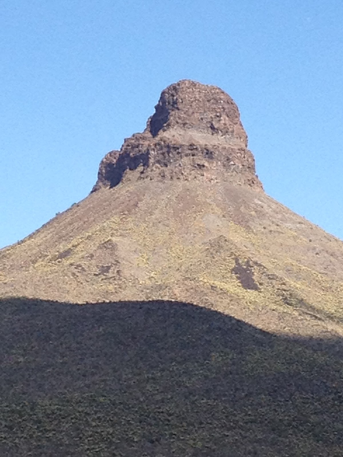
Thumb Butte, I believe. Created by a volcanic core a bizzilion years ago.
Geologic history awesome around here. Once upon a time this place was all underwater. Then it had Lava Rivers.
Now a desert.
Proof positive that all you have to do is live long enough in one spot and you will see a lot of changes :-)

You know, some of these vehicles don't look all that old to me.
What does that mean???


(To Be Continued In "Day 4 -- Part 2" Coming Soon)